BMTC Bus Timings & Stops

Find Best Job near you
Discover full-time, part-time, and work-from-home opportunities.
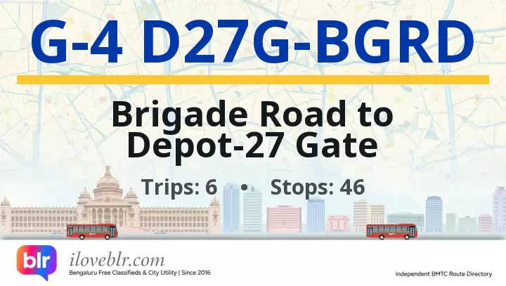
Route G-4 D27G-BGRD — Key Facts
Updated 20 Oct 2026- Route number
- G-4 D27G-BGRD
- Origin
- Brigade Road
- Destination
- Depot-27 Gate
- Total stops
- 46
- Daily pass
- ₹95
- Monthly pass
- ₹1,400
- Trips per day
- 6
- Service type
- Ordinary Bus
- First bus
- 11:50 AM
- Last bus
- 6:25 PM
schedule Schedule & Timings ▼
11:50 12:00 12:10 17:25 17:55 18:25
Stop-by-Stop Sequence
46 total stops
1
Brigade Road
🚇
▼
Brigade Road bus stop is on Brigade Road in central Bengaluru, the city's best-known shopping and entertainment street, running from the MG Road junction south to Residency Road. It is lined with brand stores, bookshops, pubs, restaurants and the historic St Patrick's Church, and connects to Church Street, Residency Road, MG Road and Richmond Road. The MG Road metro station on the Purple Line is a short walk away, and the stop serves shoppers, tourists and office-goers heading to MG Road, Shivajinagar, Koramangala, Jayanagar and Whitefield.
📍 Nearby
- Brigade Road shopping street — adjacent
- Church Street — 300 m
- St Patrick's Church, Brigade Road — 400 m
- MG Road Metro Station (Purple Line) — 400 m
- MG Road — 400 m
- Residency Road — 500 m
- Garuda Mall, Magrath Road — 600 m
- Richmond Circle — 1 km
8
Bengaluru Dairy Circle
▼
Bengaluru Dairy Circle bus stop is at the Dairy Circle junction in south Bengaluru, where Hosur Road, Bannerghatta Road and Lalbagh Road meet. It is a major BMTC interchange for buses heading towards Electronic City, Bannerghatta, BTM Layout, Hosur Road and the city centre, and sits next to the Bangalore Dairy (Karnataka Milk Federation) campus. The stop serves Adugodi, Wilson Garden, Jayanagar and BTM Layout, and is a key boarding point for commuters travelling to Electronic City and Bommasandra via Hosur Road.
📍 Nearby
- Dairy Circle Junction — adjacent
- Bangalore Dairy (KMF) campus — 300 m
- Adugodi — 800 m
- Wilson Garden — 1 km
- Forum Mall, Koramangala — 1.5 km
- Lalbagh Metro Station (Green Line) — 1.5 km
- Nimhans — 1 km
12
MICO Layout Checkpost Gopalan mall
▼
MICO Layout Checkpost Gopalan Mall bus stop is on Bannerghatta Road at the MICO Layout checkpost, beside Gopalan Innovation Mall in south Bengaluru. It serves the MICO Layout and BTM Layout residential belt, the mall, Jayadeva Institute of Cardiology and the Bannerghatta Road commercial strip, and connects to Majestic, KR Market, Jayanagar, Banashankari, BTM Layout, JP Nagar and Bannerghatta National Park.
🚌 Other buses at this stop:
📍 Nearby
- Gopalan Innovation Mall — adjacent
- MICO Layout Checkpost — adjacent
- Bannerghatta Road — adjacent
- Jayadeva Institute of Cardiology — 1 km
- BTM Layout 2nd Stage — 1.5 km
- JP Nagar 3rd Phase — 2 km
- Bannerghatta National Park — 12 km
15
Apollo Hospital
▼
Apollo Hospital bus stop is on Bannerghatta Road at the Apollo Hospitals campus in south Bengaluru, near the MICO Layout Checkpost, Gopalan Innovation Mall and Jayadeva Institute of Cardiology. Apollo Hospitals Bannerghatta Road is one of Bengaluru's largest private multi-specialty hospitals, drawing patients from across the city and neighbouring states, and the stop serves the hospital, its surrounding residential layouts and the Bannerghatta Road commercial strip. Connects to Majestic, KR Market, Jayanagar, Banashankari, BTM Layout, JP Nagar and Bannerghatta National Park.
🚌 Other buses at this stop:
📍 Nearby
- Apollo Hospitals, Bannerghatta Road — adjacent
- MICO Layout Checkpost — 500 m
- Gopalan Innovation Mall — 700 m
- Jayadeva Institute of Cardiology — 1.5 km
- BTM Layout 2nd Stage — 2 km
- JP Nagar 3rd Phase — 2.5 km
- Bannerghatta National Park — 12 km
19
Hulimavu Gate
▼
Hulimavu Gate bus stop is on Bannerghatta Road at the Hulimavu junction in south Bengaluru, near Arekere, Bilekahalli, Gottigere and the Hulimavu Lake belt. Hulimavu is a major residential locality on Bannerghatta Road with apartment clusters, schools, hospitals, local markets and the Hulimavu Cave Temple, and sits on the main corridor towards Bannerghatta National Park. Connects to Majestic, KR Market, Jayanagar, Banashankari, BTM Layout, JP Nagar and Bannerghatta.
🚌 Other buses at this stop:
📍 Nearby
- Hulimavu Gate junction — adjacent
- Bannerghatta Road — adjacent
- Hulimavu Cave Temple — 800 m
- Hulimavu Lake — 1.5 km
- Arekere — 1 km
- Bilekahalli — 1.5 km
- Meenakshi Mall — 1.5 km
- Bannerghatta National Park — 8 km
41
Jigani Double Road
▼
Jigani Double Road bus stop is on Jigani Double Road in Jigani, Anekal taluk, south Bengaluru, within the Jigani Industrial Area belt. It serves the KIADB Jigani Industrial Area units, worker housing, layouts and local markets, and connects to Bommasandra, Electronic City, Anekal, Attibele and Majestic.
🚌 Other buses at this stop:
📍 Nearby
- Jigani Double Road — adjacent
- Jigani Industrial Area (KIADB) — 500 m
- Jigani Bus Stand — 1 km
- Jigani Market — 800 m
- Bommasandra Metro Station (Yellow Line) — 8 km
- Anekal — 8 km
43
Jigani Bus Stand
▼
Jigani Bus Stand is the main bus terminus for Jigani town and the Jigani Industrial Area, in Anekal taluk of Bengaluru Urban district, on the Jigani–Bommasandra–Anekal road about 30 km south of central Bengaluru. It serves one of Karnataka's largest KIADB industrial estates — home to electronics, engineering, pharmaceutical, textile and logistics units — and handles BMTC buses from Majestic, KR Market, Shivajinagar, Electronic City, Bommasandra and Bannerghatta. The bus stand connects factory workers, warehouse staff and industrial commuters to Bengaluru city and to the Bommasandra Metro Station on the Yellow Line (RV Road–Bommasandra), the nearest operational metro, about 8 km north. Jigani is also close to Bannerghatta National Park (~10 km) and the Anekal–Attibele border belt. The surrounding area has dense worker housing, highway dhabas, small markets and industrial canteens serving the factory workforce.
🚌 Other buses at this stop:
📍 Nearby
- Jigani Bus Stand — main BMTC terminus for Jigani town and industrial area — adjacent
- Jigani Industrial Area (KIADB) — one of Karnataka's largest industrial estates, electronics, engineering and pharma units — 500 m
- Jigani Town Market — local market for vegetables, flowers and household goods — 400 m
- Bommasandra Metro Station — Yellow Line southern terminus, nearest operational metro — 8 km
- Bommasandra Industrial Area — manufacturing and industrial belt towards Hosur Road — 6 km
- Anekal — taluk headquarters and town, 8 km west — 8 km
- Attibele — Karnataka–Tamil Nadu border town, 12 km south-east — 12 km
- Bannerghatta National Park — national park, zoo and butterfly park — 10 km
- Electronic City — major IT hub on Hosur Road — 15 km
- Haragadde — village and industrial cluster near Jigani — 3 km
- Jigani Lake — small lake and walking spot in the industrial belt — 1.5 km
- Kempegowda International Airport (KIA) — via NICE Road and airport expressway — 55 km
Frequently Asked Questions
Quick answers about BMTC route G-4 D27G-BGRD
What is the route of BMTC bus G-4 D27G-BGRD? ▼
BMTC route G-4 D27G-BGRD runs from Brigade Road to Depot-27 Gate, covering 46 stops in Bengaluru. Full stop-by-stop sequence is listed above.
How many stops does BMTC route G-4 D27G-BGRD have? ▼
BMTC bus G-4 D27G-BGRD stops at 46 stops between its origin and destination (Depot-27 Gate).
Is there a daily or monthly pass for BMTC bus G-4 D27G-BGRD? ▼
Yes — the Ordinary Bus service offers a daily pass of ₹95, a monthly pass of ₹1,400. Passes are valid across all routes of the same service class.
What are the first and last bus timings for BMTC route G-4 D27G-BGRD? ▼
The first BMTC bus on route G-4 D27G-BGRD departs at 11:50 AM and the last bus departs at 6:25 PM.
What are the bus timings for BMTC route G-4 D27G-BGRD? ▼
The scheduled timings for BMTC bus G-4 D27G-BGRD are: 11:50 12:00 12:10 17:25 17:55 18:25 See the full schedule table above.
How many buses run on BMTC route G-4 D27G-BGRD per day? ▼
BMTC route G-4 D27G-BGRD operates approximately 6 scheduled trips per day between Brigade Road and Depot-27 Gate.